Growing up in India the only Peru I knew of was a tropical fruit (Guava for those whose lingua is English). Not until high school did I discover that it was also a country in the South American continent.
So it was this early April week that we decided to hit up Peru - the land of the once glorious Inca people that lived 500 years ago. Today Peru is the third largest country on that continent with a diverse geography that stretches from the drier Pacific coast plains to the high mountains of the Andes and the Amazon river valley to its east.
Our trip was primarily a pilgrimage of sorts to visit the last remaining, lost (now found and documented), large scale, mostly undamaged, city of the Inca nobility, called Machu Picchu (MP). The Inca were great architects and builders. MP is a UNESCO world heritage site affording it high visibility to the tourism trade and therefore crowded year round. Our timing was not quite high season allowing us the luxury of less crowded hill slopes and mild climate for most part.
Historians have documented that when Spanish conquerors moved to the continent in the 16th century they demolished existing and indigenous buildings en masse replacing with their own colonial style behemoths, beautiful and awe inspiring for the locals. But MP remained hidden due in part to its remote location some 8,000 feet above sea level in the Andes jungles.
That allowed it to not be demolished by the Spaniards and it was discovered in 1911 by an American explorer called Hiram Bingham.
 |
| The Hiram Bingham is the luxury train service between Cuzco and AC (tracks in the portion between Cuzco and Olantay are washed out so only available between Olantay and AC) |
Since then MP has been cleaned and surrounding dense brush cleared to reveal an archeological marvel of mid 16th century. The project was led by the chief designer called Pachacutic, that showcases knowledge of astronomy, hard construction material handling, cutting and moving to form this amazing city in the clouds.
There are also effective drainage and plumbing ideas that served to move water efficiently into this walled city to its dwellings and condominiums that served everyone from high priests to locals. Farming was done on stepped balconies that could produce different crops through the seasons.
- Getting to MP is not an easy feat even to this day. The basic plot for someone like us visiting from North America is to get a plane ride to Lima (coastal capital city of Peru).
 |
| Lima waterfront (near Mira Flores District) |
 |
| Beautiful sunsets - Malecon in Mira Flores, Lima |
 |
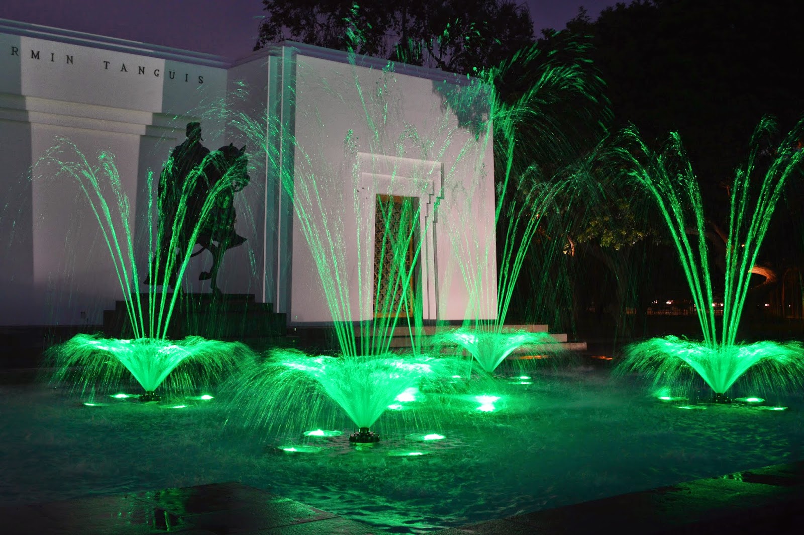
| Park reserve in Lima - Magic Water Tour is currently the world record holder for the largest fountain complex in the world |
 |
| Magic Fountains - Lima at night |
2. Then another short hop flight to Cuzco (about 500 miles due southeast of Lima), which was the seat of the Inca empire during its heyday. Cuzco sits around 11,000 feet above sea level in the longest running mountain chain of the Andes, and folks have been known to develop shortness of breath and headaches when wandering its surrounds.
.  |
| Cuzco Airport - 11,200 ft above sea level |
3. We continued straight on through by road from Cuzco airport to a lower altitude village of Ollantytambo some 40 miles to the north.
 |
| Bienvenidos (welcome to Ollantay) |
4. Ollantaytambo serves as a rail head for a 3m narrow gage train run by a private outfit called PERU RAIL. You need to get on this train for a 90 min ride downhill for 40 km (or 25 miles) to the village of Aguas Calientes (AC), the base camp for the final leg to MP. AC is around 8,000 feet elevation.
The journey is one of the most spectacular rail adventures that I have experienced. You follow the river valley watching the green mountain with its abundant variety of flora (including cactus) that grow on the banks of the Urubamba river as your ink blue and gold train curves downhill (or up on the way back).
 |
| Peru Rail - daily services between Olantay to AC/MP |
 |
| Peru Rail crossing through the Urubamba river valley |
The final leg happens to be a Mercedes Benz bus ride from AC (along the Urubamba river) to the top of the mountain where the site is located. Once at the gate you can begin hiking three different hikes -
- To the Sun Gate (from where you can see the actual citadel of MP with Huayna Picchu (HP) mount in the background.
- The other hikes are to walk to the MP hill or
- hike the HP hill which is 1,200 feet above the MP site.
 |
| Nature's colors along the hike from MP gate to Inki Timpu (Sun Gate) |
Here then are some glimpses into what this ancient Inca condo complex looks like today -
 |
| The Citadel of MP - viewed from hike back from Sun Gate |
 |
| Iconic MP image - HP in background |


I had seen it in a Rajnikant movie-Robot. Looks fascinating, even the setting.
ReplyDelete